
Overview of the Disaster and Objectives
Disaster Overview
In January and February 2026, Mozambique was struck by a catastrophic humanitarian crisis as torrential rains from Tropical Cyclone FYTIA and the subsequent intense Tropical Cyclone GEZANI devastated the region. The relentless rainfall, combined with massive river inflows from upstream neighboring countries, left the soil completely saturated and major river basins well above alert levels.
According to reports from UN OCHA (United Nations Office for the Coordination of Humanitarian Affairs)/UNDAC (United Nations Disaster Assessment and Coordination) and the Mozambique National Institute for Disaster Management (INGD) situation updates, the scale of the disaster was immense:
· Human Impact: Over 700,000 people were affected, with more than 200,000 people displaced.
· Infrastructure Damage: Tens of thousands of homes were destroyed. Critical infrastructure, including over 200 health facilities and over 313,000 hectares of agricultural land, was inundated, sparking severe concerns over food security and the spread of waterborne diseases like cholera.
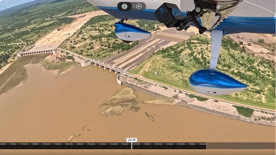
· Focus Area: The Massingir Dam in Gaza Province became a point of extreme concern. With the reservoir reaching full capacity, there was an imminent risk of emergency discharges that would further devastate downstream communities such as Chokwe.
Source: Mozambique: 2026 Flood Humanitarian Response - as of 9 February 2026 | OCHA
![Figure 1. Rescue efforts continue for hundreds of families cut off by flooding, with some taking refuge on rooftops, car roofs, or in treetops in southern Mozambique after days of near-continuous rain that has also forced dams, including some in neighbouring countries, to increase water releases. [Luisa Nhantumbo/EPA],](https://www.un-spider.org/sites/default/files/Rescue%20efforts_0.jpg)
Objectives of this Web Report
Following the activation of the Assessment and Analysis (A&A) Cell, led by UN OCHA, and the deployment of the UNDAC team, UN-SPIDER contributed to the work of the A&A cell and the deployed UNDAC team as official remote support partner by providing specialized VHR remote sensing SAR imagery. The specific objectives for this mission were:
· Massingir Dam Monitoring: To support the monitoring of the dam and its reservoir levels using Very High Resolution (VHR) SAR imagery to provide additional analytical data to improve the situational assessment conducted by the UNDAC team.
· Additional Analysis Data for UNDAC Experts: To deliver analyzed satellite products to the Environmental Experts of the UNDAC team prior to their site visit, ensuring they had a remote "first look" at the flood conditions and accessibility before conducting physical inspections.
· Provision of SAR Images of the dam: To assist with priority mapping and support INGD and humanitarian partners in identifying safe logistics routes and prioritizing areas for life-saving interventions.
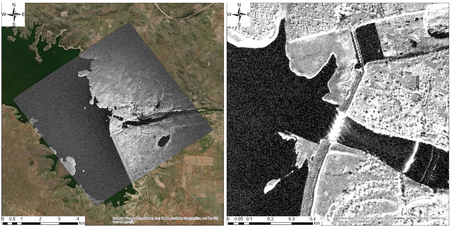
Satellite-Based Monitoring of Massingir Dam
To meet the urgent requirements of the UNDAC team, UN-SPIDER collaborated with the Japanese SAR constellation operator iQPS. The use of iQPS's high-resolution SAR data was critical for obtaining clear imagery of the dam despite the persistent storm clouds and heavy rain.
Monitoring Results from iQPS (QPS-SAR)
The high-resolution snapshots provided by iQPS allowed the team to:
- Detect immediate changes in water levels and the extent of the reservoir's expansion in near-real-time.
- Identify surface anomalies and debris accumulation near the dam wall and spillways.
- Map the surrounding flooded areas to assess the impact on roads and access points leading to the dam.
This timely data provided the UNDAC team with vital information regarding the environmental conditions at the site before their arrival.
Potential of Satellite Constellations in Disaster Response and UN-SPIDER's Role
The 2026 Mozambique floods highlighted the indispensable role of SAR satellite constellations like iQPS. The ability to "see" through heavy storm clouds and provide data at high revisit rates allowed for a level of persistent monitoring that was previously impossible during tropical cyclones.
In the context of the Massingir Dam, this technology provided:
· Enhanced Situational Awareness: Providing current flood maps to UNDAC experts before they entered high-risk zones.
· Rapid Response Support: Enabling INGD to monitor the status of critical water infrastructure 24/7, regardless of weather conditions.
UN-SPIDER’s role remains centered on bridging the gap between space technology and humanitarian action. By translating complex SAR data into clear, analysed products for the UNDAC team, UN-SPIDER ensures that advanced space-based information is used effectively to save lives and protect critical infrastructure in the face of climate-induced disasters.