![]()
United
Nations
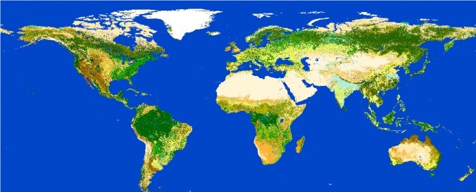
Land Cover (ESA CCI)
| Data provided by: | European Space Agency (ESA) |
| Data accessibility: | export data |
| Link to the data: | |
| Data type: | land use, land cover data |
| Disaster cycle phase: | Disaster Risk Management |
| Spatial coverage: | Global |
| Spatial resolution: | 300 |
| Temporal coverage: | Archive |
| Content dates: | 1998-2012 |
| Technical Specifications: | |
| Costs: | free |
| Contact: | ESA Climate Change Initiative |
| Tutorials on the use of data: | Product User Guide v. Sept. 2014 (ESA CCI LC), Quick user guide maps v. Aug. 2014 (ESA CCI LC), Quick user guide land surface seasonality products v. Aug. 2014(ESA CCI LC) |
| Restrictions/ Citation of the dataset: |
© ESA Climate Change Initiative - Land Cover led by UCLouvain (2017) |
Provider
![]()