![]()
United
Nations
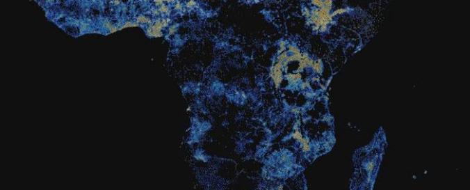
Africa High Resolution Population Density Maps (CIESIN)
| Data provided by: | Center for International Earth Science Information Network (CIESIN) - Columbia University |
| Data accessibility: | export data, export map |
| Link to the data: | |
| File type: | tiff |
| Data type: | baseline data, land use, land cover data |
| Disaster cycle phase: | Disaster Risk Management, Response, Recovery |
| Space-based Information: | Facebook, in conjunction with Center for International Earth Science Information Network (CIESIN), has utilized artificial intelligence (AI) to identify buildings from commercially available satellite images and create high resolution population density maps. This data set covers the majority of Africa and can be downloaded in bulk for the continent or by specific countries. |
| Satellites and Sensors: | Sentinel-2A |
| Spatial coverage: | Africa |
| Temporal coverage: | Archive |
| Content dates: | 2019 |
| Costs: | free |
| Tutorials on the use of data: | Case study - Mapping for humanitarian aid |
Provider
![]()